Dance of a Peacock - Pakistan
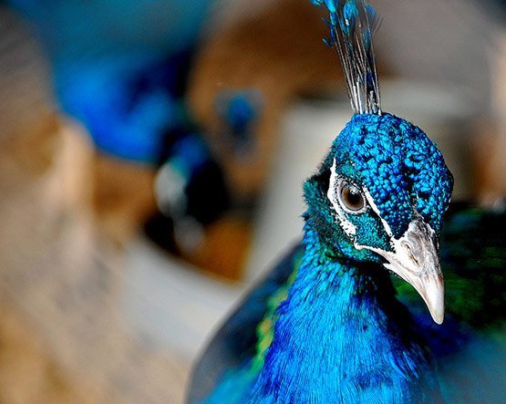
There is a peaock breeding barn infront of the Guest House where
I'm staying. It has more than 30 peacocks from different colors.
Unfortunately, all kept behind the chain link.
Faisal Mosque, Islamabad, Pakistan

The Shah Faisal Masjid in Islamabad, Pakistan - is among one of the
largest mosques in the world. Its Pakistan’s National Mosque. It is a
popular masjid in the Islamic world, and is renowned for both its size
and its architecture covering an area of 5,000 square meters with a
capacity of 300,000 worshippers. It’s relatively unusual design fuses
contemporary lines with the more traditional look of an Arab Bedouin's
tent, with its large triangular prayer hall and four minarets.
Jahangir Kothari, Karachi

Single RAW HDR processing on photomatix from my Canon 400D.Photo at Jahangir Kothari parade, Karachi, Pakistan.
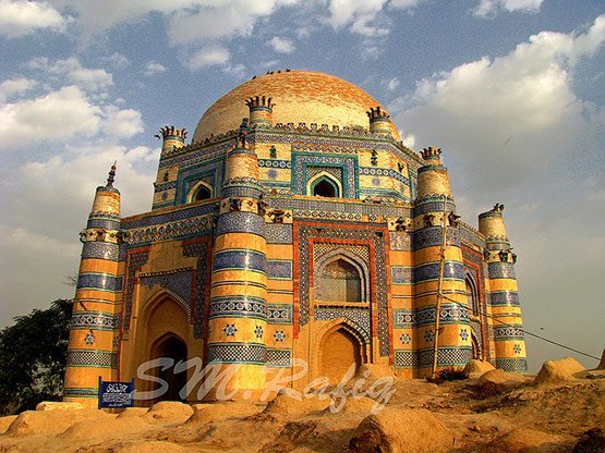
The Tomb of Jam Nido at Makli Hills, Thatta, Sindh, Pakistan
This is the tomb of Jam Nido, a Summa ruler who reigned from
1461-1508.One of the largest necropolises in the world, with a diameter
of approximately 8 kilometers, Makli Hill is supposed to be the
burial place of some 125,000 Sufi saints. It is located on the outskirts
of Thatta, the capital of lower Sind until the seventeenth century,
in what is the southeastern province of present-day Pakistan.
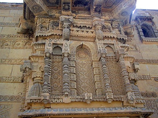
Shrine of Bibi Jawindi, Uch Sharif in Beautiful Pictures of Pakistan
Uch or Uch Sharif is located in Punjab, Pakistan. Uch is also
known as "Alexandria at the Head of the Punjab", is a historical city
in Pakistan. Once it was an important city of ancient India. It
is believed that in 325 BC Alexander the Great founded a city
called Alexandria at the site of the last confluence of Punjab rivers
with the Indus river.
Arambagh Mosque, Karachi

An illuminated view of colorful lights installed over the Aram Bagh Mosque in connection with Shab-e-Barat.
Derawar Fort, Cholistan, Pakistan
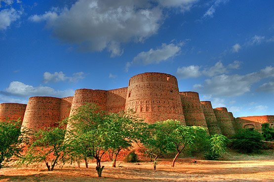
Derawar Fort is an ancient fort located in Cholistan Desert
in Pakistan. The Fort was built by Deoraj, a prince of Jaisalmer. It
was in possession of royal family of Jaisalmer when it was captured
by Abbasis in 1735. In 1747, the Fort slipped from the hands of
Abbasis in the reign of Nawab Bahawal Khan due to his pre-occupations
at Shikarpur. Nawab Mubarak Khan took the stronghold back in 1804.
The Astore Valley in the Northern Areas of Pakistan

Astore Valley (el. 2,600 m (8,500 ft)) is located in Astore
District in the Northern Areas of Pakistan. The valley, adjoining the
eastern side of mountain Nanga Parbat, is about 120 km (75 mi) long,
having area of 5,092 km2 (1,966 sq mi).[citation needed]The entrance of
the valley is located about 60 km southeast of Gilgit with four
side-valleys. The valley has more than 100 villages with a total
population of 71,666 (Census 1998)[citation needed], including Chilm,
Bubin, Gorikot, Eid Ghah, Fina, Bulen, Chongra and Tari Shing. Chilm is
the most beautiful village among all the villages of Astore, because it
is the starting point of Deosai, the world's second highest plateau. The
majority of people practice subsistence agriculture and livestock is
the main source of livelihood complemented by seasonal work in down
districts of the country. Due to its diverse landscape and climatic
conditions the valley provides excellent habitat for a variety of
commercially important medicinal plants.
Warrior and his Sword in Beautiful Pictures of Pakistan

Before the opening of four in line tent pegging category only he was honored to lift this peg with sword instead of Lance.
Sunset at GT Road, Pakistan
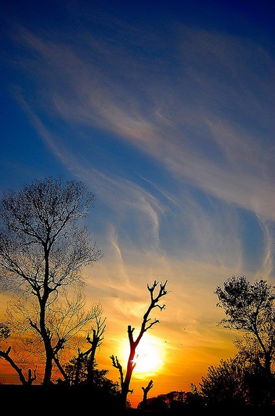
Even though it is Winter, sunset is still colorful and bright in Pakistan.
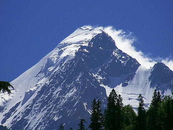
Beautiful Pakistan - View from Lord of the Rings
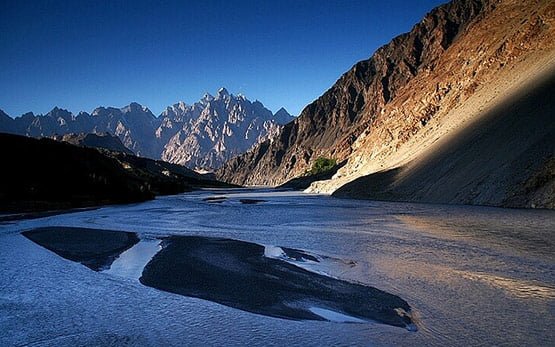
This is a view of Tupopdan mountain, one of the most amazing places along Karakoram highway.
The Karakoram is a ‘who’s who’ of the world’s tallest peaks –
including K-2, second only to Everest. And its valleys deliver a glut of
glaciers, the longest outside the polar regions, with some creeping
right to the road edge. The 240-kilometer Hunza Valley is an ancient and
remote kingdom in the northeast of Pakistan, nestled close to China and
the Wakhan Corridor of Afghanistan. The simplicity of village life
belies the valley’s strategic and economic importance. Not so many years
ago, travel through its narrow gorges and high passes was treacherous
as local brigands supplemented meagre agricultural outputs by raiding
silk route caravans, trading slaves and capturing loot.
Pakistan - Amazing Scary Suspension Husaini Bridge
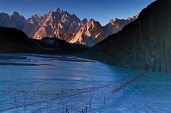
This is a shot of Mt. Tupopdan (6106m) taken at the sunset with new
and old suspension Husaini Bridge in foreground. Probably one of the
more instantly recognizable pictures you'll see in books and promotional
pictures of Pakistan is of the numerous suspension bridges that cross
the rivers in and around Northern Pakistan. And in saying that, one of
the more famous day treks around the region is known as the Two Bridges
trek which as the name suggests sees you crossing two bridges on a five
hour trek in the area surrounding Passu and the neighboring villages
before ending at Borit Lake.The trek itself is probably more of a
pleasant stroll than a strenuous effort but the setting and the scenery
is some of the best I've seen so far. Apart from crossing the two
bridges you meander through farming villages, traverse steep ravines,
cross potato and pumpkin fields as the farmers wave hello and end the
day by enjoying a nice cold drink by an alpine lake.
Pakistan - Fairy Meadows - Circles of Life
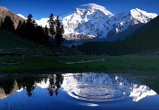
The mountain in the picture is Nanga parbat (also known as
Nangaparbat Peak or Diamir) is the 9th highest mountain on Earth and the
2nd highest in Pakistan. Nanga Parbat has tremendous vertical relief
over local terrain in all directions. To the south, Nanga Parbat boasts
what is often referred to as the highest mountain face in the world: the
Rupal Face rises an incredible 4,600 m (15,000 feet) above its base. To
the north, the complex, somewhat more gently sloped Rakhiot Flank rises
7,000 m (22,966 feet) from the Indus River valley to the summit in just
27 km, one of the 10 greatest elevation gains in so short a distance on
Earth. Nanga Parbat is the fastest growing mountain on Earth and it is
still growing about 7mm a year.
Falaksair Peak Swat Valley in Amazing Pictures Pakistan
Wonderfull view of snow covered peak Falaksair from Swat valley (Pakistan)
Shahjahan Masjid-Pakistan
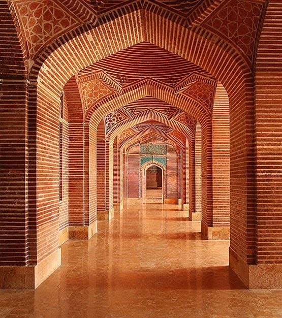
The Shah Jahan Mosque was built in the reign of Mughal emperor Shah
Jahan. It is located in Thatta, Sindh province, Pakistan. In the town of
Thatta (100 km / 60 miles from Karachi) itself, there is famous
Shahjahani Mosque with its beautiful architecture. This mosque was built
in 1647 during the reign of Mughal King Shahjahan, also known as the
builder King. The mosque is built with red bricks with blue coloured
glaze tiles probably imported from another Sindh's town of Hala.


